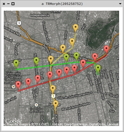
Hello! I created this tiny project for querying Google's Geocoding and Static Maps APIs. The maps are turned into Roassal2 elements with the map as a shape. Below is a sample using the names of some stations of Santiago's subway network, marking their locations and drawing the path between them.
|v map linea1 linea2 linea5 metrificar | metrificar := [ :s | 'Metro ', s, ', Santiago Chile' ].
linea1 := #( 'Salvador' 'Baquedano' 'Universidad Catolica' 'Santa Lucia' 'Universidad de Chile' 'La Moneda' 'Los Heroes' 'Republica' 'Union Latino Americana' 'Estacion Central') collect: [ :s | (GoogleMaps geocode: (metrificar value: s)) location ].
linea2 := #( 'Cerro Blanco' 'Patronato' 'Puente Cal y Canto' 'Santa Ana' 'Los Heroes' 'Toesca' 'Parque O Higgins') collect: [ :s | metrificar value: s ].
linea5 := #( 'Parque Bustamante' 'Baquedano' 'Bellas Artes' 'Plaza de Armas' 'Santa Ana' 'Cumming' 'Quinta Normal') collect: [ :s | metrificar value: s ].
v := RTView new. map := StaticMap new hybrid. map addMarkers on: linea1; color: 'red'. map addPath points: linea1; color: 'red'.
map addMarkers on: linea2; color: 'yellow'. map addPath points: linea2; color: 'yellow'. map addMarkers on: linea5; color: 'green'. map addPath points: linea5; color: 'green'. v add: map getMap @ RTDraggable. v open
[image: Imágenes integradas 1] The project can be found in http://www.smalltalkhub.com/mc/smaass/GMaps/main . Any suggestions will be appreciated!