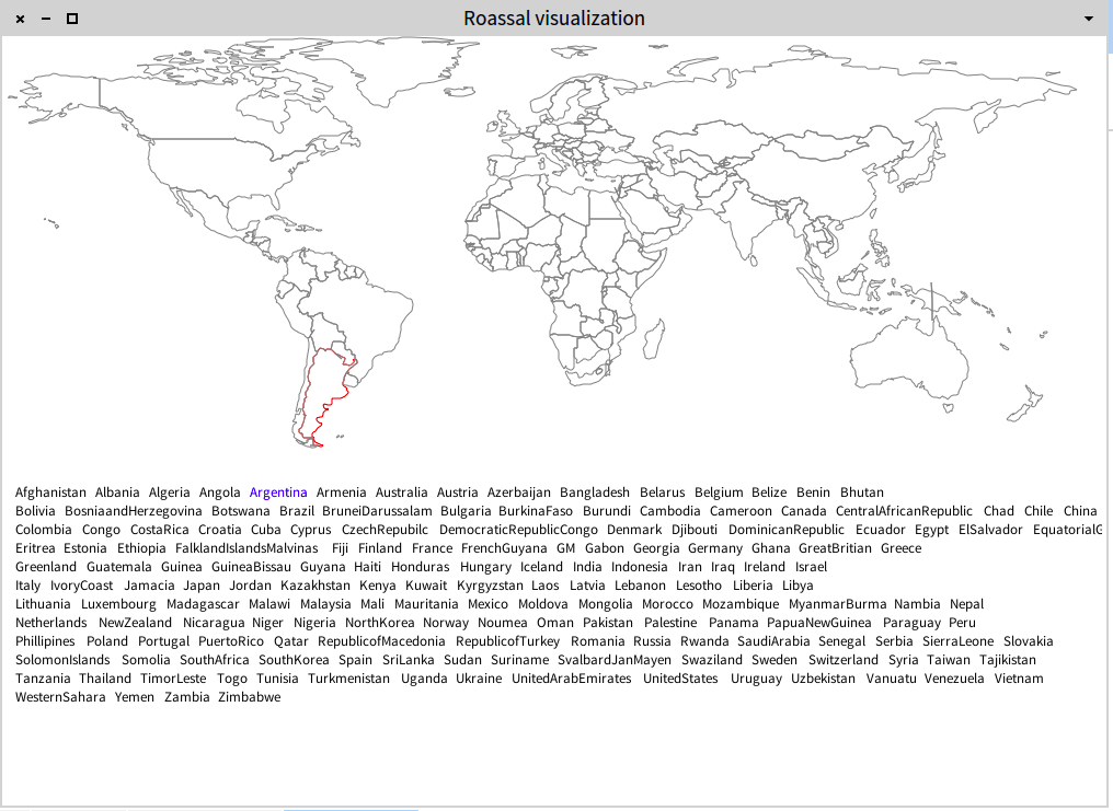
Hi! I had fun understanding how countries may be described using SVG. Here is a first shoot: Moving the mouse above a country name highlight the country. You can now rehearse your geography. The complete source code of this example is: -=-=-=-=-=-=-=-=-=-=-=-=-=-=-=-=-=-=-=-= | view element nameComponent label | view := ROView new. ROSVGPath countries do: [ :k | element := (ROSVGPath path: (ROSVGPath perform: k)) elementOn: k. view add: element. ]. nameComponent := ROElement new. ROSVGPath countries do: [ :k | label := ROLabel elementOn: k asString. label @ ROLightlyHighlightable. label on: ROMouseEnter do: [ :event | ROBlink highlight: (view elementFromModel: event model asSymbol) ]. label on: ROMouseLeave do: [ :event | ROBlink unhighlight: (view elementFromModel: event model asSymbol) ]. nameComponent add: label. ]. ROGridLayout new gapSize: -3; lineItemsCount: 15; on: nameComponent elements. view add: nameComponent. nameComponent translateTo: 0 @ 400. view openInWindowSized: 1000 @ 700 -=-=-=-=-=-=-=-=-=-=-=-=-=-=-=-=-=-=-=-= Cheers, Alexandre -- _,.;:~^~:;._,.;:~^~:;._,.;:~^~:;._,.;:~^~:;._,.;: Alexandre Bergel http://www.bergel.eu ^~:;._,.;:~^~:;._,.;:~^~:;._,.;:~^~:;._,.;:~^~:;.